Legrena-to-Aghios Konstadinos, Greece
Directions
for the route through
the Legrena Valley
(This is a small part of a greater area called Lavriotiki)
Note 1: The distances below were measured by car odometer and may not agree exactly with another car's odometer - due to various factors including tyre wear it could vary by 10%. Resetting the odometer at known positions eliminates the accumulated mileage error.
Note 2:
LHS = Left hand side, RHS = Right hand side
Note 3: Some (but not all) points of interest along the journey are described.
Refer to map for more information.
Directions
for the route through the Legrena Valley
The starting
point is the church in Legrena called
Panagia Eleousa which will be on your right-hand side as you progress in a northerly
direction along Leoforos Theseos after turning in to Legrena from the main coastal
road.
(Reset your Odometer here)
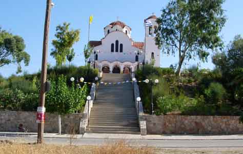
- At 0.00 Km Panagia Eleousa church steps (the only church in Legrena)
- At 0.35 Km Start of Odos Profit Ilias (which later becomes Leoforos Legrainon)
- At 2.00 km Iliou Street on LHS
- At 2.20 Km Helithonas Street on LHS (Asphalt ends, dirt road begins - 2006)
- At 2.60 Km Egnikou Drimou Street on RHS
- At 3.35 Km Saint Nektariou Street on LHS
- At 3.45 Km Perdikas Street on LHS
- At 3.70 Km Aetomahou Street on LHS
- At 3.80 Km Geranon Street on RHS
- At 4.15 Km Leoforos Legrainon Avenue changes to Aghios Konstadinou (Take Right-hand fork in road). This road continues through the Legrena valley all the way to Aghios Konstadinos.
- At 4.30 Km Shinou Street on LHS
- At 4.65 Km Dirt track on LHS leading up a hill
- At 4.90 Km Dirt road on RHS leading to a pink-coloured building and a fenced agricultural facility
- At 5.10 Km Dirt track on LHS heading directly at Pousipelia peak (intersects with Athinas Street)
- At 5.16 Km Vertical shaft surrounded by a wall on RHS next to road
- At 5.20 Km Vertical shaft surrounded by a wall on RHS next to road
- At 5.45
Km Athinas Street (dirt road) on LHS leads around the base
of Pousipelia peak (NOTE:
This distance confirmed)
[0.00 m] (Reset
your Odometer here for more precision - optional)
- At 5.75
m Dirt road on LHS leading to line of Rectangular
Washeries on LHS in 550 m (down slope, behind twin pine trees
on the LHS)
[300 m]
- At 5.75
m Dirt road on RHS leading up Berseka hill
& Vertical shaft on LHS in 150 m (also
Mines on the RHS)
[300 m]
- At 5.76
Km Large EU Sign on LHS (relating
to the replanting of pine trees burnt by a forest fire)
[310 m]
- At 5.80
Km Dirt track on LHS joining-up with the previous road
[350 m]
- At 5.85
Km Dirt track on LHS leading up to a Cistern,
Rectangular Washery & 2 fenced Vertical shafts
[400
m]
- At 6.05
Km Dirt road on RHS leading up Haos
mountain
[600 m]
- At 6.30
Km Dirt track (short) on RHS leading to piles of mining discard
[850 m]
- At 6.55
Km Dirt track on RHS ( this intersects with dirt road leading
North to the huge cavity in the ground)
[1,100 m]
- At 6.85
Km Observe on RHS a huge Abyss with
mines & on LHS a picnic area
[1,400 m]
- At 6.90
Km Road junction and Fountain
(Aghios Konstadinos church is on road at LHS)
[1,450 m]
- At 6.90
Km Turn RIGHT and continue on road towards Aghios Konstadinos
village
[1,450 m]
- At 7.35
Km Turn RIGHT onto Aghios Konstadinos village main road (by
Statue of a miner)
[1,900
m]
- At 7.35
Km Observe on LHS a 18th Century mine complex with tower
[1,900 m]
- At 7.55
Km Observe on LHS the Aghios Konstadinos village petrol station
(EKO) with mineral display
[2,100 m]
PHOTO ASSISTANCE:
See Views
page for some other helpful photos.
Panagia
Eleousa church (Reset your Odometer here)
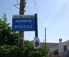
Sign
for Leoforos Theseos (i.e. Theseos
Avenue)
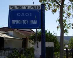
Sign
for Odos Profit Ilias (i.e. Profit
Ilias Street)
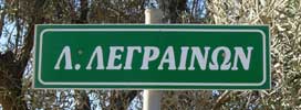
Sign for Leoforos Legrainon (i.e. Legrainon Avenue)
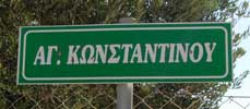
Sign for Aghios Konstadinou street (i.e. Saint Konstadinou street)
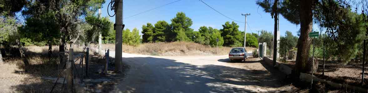
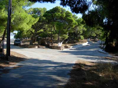
Aghios Konstadinou
street branches
RIGHT from Leoforos
Legrainon
(Go right here).
(Use horizontal scroll RIGHT for complete view of photograph)
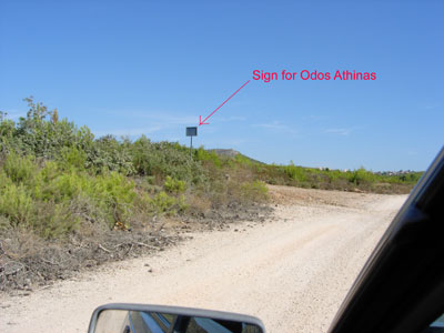
The back-side
of the sign for Odos Athinas as seen travelling North to Agios. Konstadinos
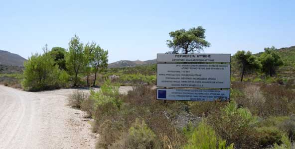
EU sign
about funding the replanting of trees after the fire (looking South towards
Legrena)
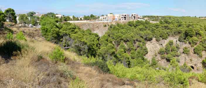
Abyss &
Aghios Konstadinos as seen from the south - just before reaching the fountain.
The junction
at the fountain at Aghios Konstadinos as seen looking South.
(The car is on Aghios Konstadinou street ready to enter the Legrena valley)
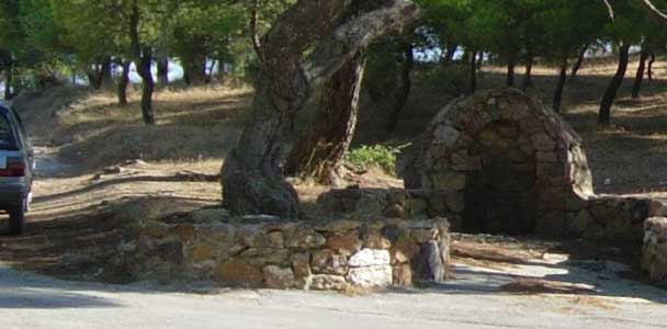
Close-up
of the Fountain at the junction just below Aghios Konstadinos looking South.
(see previous photo)
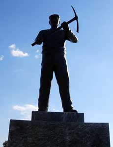
Statue of
a miner in Aghios Konstadinos
(on the main road through the village)
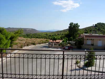
View of the Legrena Valley (looking south) from the statue of a miner